Helsinki virtual tour
Introduction
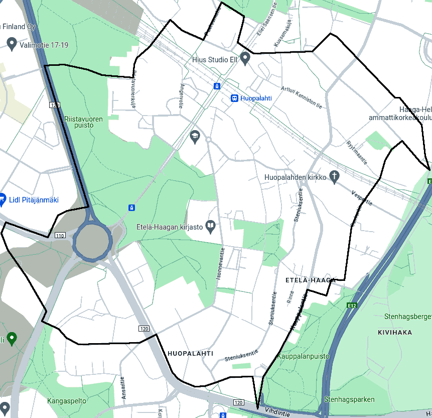
This set of static HTML pages lets you move around southern Haaga (Haga) district in Helsinki. To start the tour, select an intersection and a view direction under Photos below.
Photos
| Street 1 | Street 2 | Directions |
|---|---|---|
| Ahjokuja/Ässjegränd | Ristolantie/Kristersvägen | east, southwest, west, northwest |
| Ahjokuja/Ässjegränd | Steniuksentie/Steniusvägen | northeast, southeast, southwest, northwest |
| Ahjokuja/Ässjegränd | Vanha Turun maantie/Gamla Åbo landsväg | east, southeast, west, northwest |
| Ahjokuja/Ässjegränd | none | northeast, southeast |
| Angervotie/Spireavägen | Huopalahti station western underpass | north, northeast, south, southwest |
| Angervotie/Spireavägen | Isonnevantie/Stormyrvägen | north, southeast, south, west |
| Angervotie/Spireavägen | Seljatie/Flädervägen | north, southeast, south, northwest |
| Angervotie/Spireavägen | none | northeast, southeast, southwest, northwest |
| Ansaritie/Orangerivägen | Viertotien aukio/Chausséplan | northeast, southwest, west |
| Artturi Kanniston tie/Artturi Kannistos väg | Eliel Saarisen tie/Eliel Saarinens väg | northeast, southeast, southwest, northwest |
| Artturi Kanniston tie/Artturi Kannistos väg | Haagan pappilantie/Haga prästgårdsväg | north, southeast, southwest, northwest |
| Artturi Kanniston tie/Artturi Kannistos väg | Tunnelitie/Tunnelvägen | north, southeast, south, northwest |
| Artturi Kanniston tie/Artturi Kannistos väg | none | northeast, southeast, southwest, northwest |
| Bensa-asemankuja/Bensinmacksgränden | Vihdintie/Vichtisvägen (south of Haaga roundabout) | north, northeast, south, southwest |
| Bensa-asemankuja/Bensinmacksgränden | Yhteiskouluntie/Samskolevägen | northeast, southeast, south, southwest |
| Eliel Saarisen tie/Eliel Saarinens väg | Haaga roundabout | northeast, south, southwest, west |
| Eliel Saarisen tie/Eliel Saarinens väg | Isonnevankuja/Stormyrgränden | northeast, southeast, southwest, northwest |
| Eliel Saarisen tie/Eliel Saarinens väg | Isonnevantie/Stormyrvägen | northeast, southeast, southwest, northwest |
| Eliel Saarisen tie/Eliel Saarinens väg | Laajasuontie/Degermyrvägen | northeast, southeast, southwest, northwest |
| Eliel Saarisen tie/Eliel Saarinens väg | Seljatie/Flädervägen | northeast, southeast, southwest, northwest |
| Eliel Saarisen tie/Eliel Saarinens väg | none | northeast, southeast, southwest, northwest |
| Eliel Saarisen tie/Eliel Saarinens väg | railway | northeast, southeast, southwest, northwest |
| Haaga roundabout | Huopalahdentie/Hoplaksvägen | north, northeast, east, southwest |
| Haaga roundabout | Regional road 110 | northeast, east, southeast, west |
| Haaga roundabout | Vihdintie/Vichtisvägen (north of Haaga roundabout) | north, east, southeast, south, southwest, west |
| Haaga roundabout | Vihdintie/Vichtisvägen (south of Haaga roundabout) | north, southeast, west, northwest |
| Haagan pappilantie/Haga prästgårdsväg | Laajasuontie/Degermyrvägen | north, east, south, west |
| Haagan pappilantie/Haga prästgårdsväg | Tunnelitie/Tunnelvägen | northeast, southeast, southwest, northwest |
| Haagan pappilantie/Haga prästgårdsväg | none | northeast, southeast, southwest, northwest |
| Haagan pappilantie/Haga prästgårdsväg | none2 | northeast, southeast, southwest, northwest |
| Haagan tori/Haga torg | Kauppalantie/Köpingsvägen | northeast, southeast, southwest, northwest |
| Haagan tori/Haga torg | none | northeast, southeast, southwest, northwest |
| Haagan urheilutie/Haga sportväg (at or north of Lärkan roundabout) | Isonnevantie/Stormyrvägen | northeast, southeast, south, southwest, northwest |
| Haagan urheilutie/Haga sportväg (at or north of Lärkan roundabout) | Kylätie/Byavägen | northeast, east, south, northwest |
| Haagan urheilutie/Haga sportväg (south of Lärkan roundabout) | Isonnevanpolku/Stormyrstigen | northeast, east, southwest, northwest |
| Haagan urheilutie/Haga sportväg (south of Lärkan roundabout) | Kauppalantie/Köpingsvägen | northeast, southeast, south, west, northwest |
| Haagan urheilutie/Haga sportväg (south of Lärkan roundabout) | Kylätie/Byavägen | southeast, south, west, northwest |
| Haagan urheilutie/Haga sportväg (south of Lärkan roundabout) | Robert Hermansonin tie/Robert Hermansons väg | north, east, south, west |
| Haaganpuisto path | none | north, east, south, west |
| Hellemäenpolku/Hetbackastigen | Vanha viertotie/Gamla chaussén (east of Huopalahdentie/Hoplaksvägen) | north, east, south, west |
| Hellemäenpolku/Hetbackastigen | Vihdintie/Vichtisvägen (south of Haaga roundabout) | northeast, southeast, southwest, northwest |
| Hellemäenpolku/Hetbackastigen | none | north, east, south, west |
| Huopalahdentie/Hoplaksvägen | Vanha viertotie/Gamla chaussén (east of Huopalahdentie/Hoplaksvägen) | north, east, south, west |
| Huopalahdentie/Hoplaksvägen | Vanha viertotie/Gamla chaussén (west of Huopalahdentie/Hoplaksvägen) | north, east, south, northwest |
| Huopalahti station platform | none | northeast, southeast, southwest, northwest |
| Isonnevankuja/Stormyrgränden | Isonnevantie/Stormyrvägen | north, east, south, west |
| Isonnevanpolku/Stormyrstigen | Isonnevantie/Stormyrvägen | north, northeast, south, southwest |
| Isonnevantie/Stormyrvägen | Helsingin Suomalainen Yhteiskoulu eastern entrance | north, east, south, west |
| Isonnevantie/Stormyrvägen | Helsingin Suomalainen Yhteiskoulu southern entrance | northeast, southeast, southwest, northwest |
| Isonnevantie/Stormyrvägen | Kylänevankuja/Bymossagränd | north, east, south, west |
| Isonnevantie/Stormyrvägen | Kylänevantie/Bymossavägen | north, east, south, west |
| Isonnevantie/Stormyrvägen | Talontie/Hemmansvägen | northeast, southeast, southwest, northwest |
| Isonnevantie/Stormyrvägen | Vihdintie/Vichtisvägen (south of Haaga roundabout) | northeast, southeast, southwest, northwest |
| Isonnevantie/Stormyrvägen | Yhdistystie/Föreningsvägen | north, east, southwest, west |
| Kangaspellontie/Malmåkersvägen | Vanha viertotie/Gamla chaussén (east of Huopalahdentie/Hoplaksvägen) | north, southeast, south, northwest |
| Karvaamokuja/Garverigränden | Vihdintie/Vichtisvägen (north of Haaga roundabout) | north, east, south, west |
| Kauppalankuja/Köpingsgränden | Kauppalantie/Köpingsvägen | southeast, south, west, northwest |
| Kauppalankuja/Köpingsgränden | Sankaritie/Hjältevägen | northeast, southeast, south, northwest |
| Kauppalantie/Köpingsvägen | Kylänevantie/Bymossavägen | north, east, south, west |
| Kauppalantie/Köpingsvägen | Paljerinne/Bälgbrinken | northeast, southeast, southwest, northwest |
| Kauppalantie/Köpingsvägen | Tunnelitie/Tunnelvägen | northeast, southeast, south, northwest |
| Kauppalantie/Köpingsvägen | Vanha Turun maantie/Gamla Åbo landsväg | northeast, east, south, west |
| Kauppalantie/Köpingsvägen | Vihdintie/Vichtisvägen (south of Haaga roundabout) | north, east, south, west |
| Kauppalantie/Köpingsvägen | none | northeast, southeast, southwest, northwest |
| Kauppalantie/Köpingsvägen | none2 | north, east, south, west |
| Kuusamakuja/Kaprifolgränden | Laajasuontie/Degermyrvägen | northeast, east, southwest, west |
| Kylänevankuja/Bymossagränd | Kylätie/Byavägen | north, east, south, west |
| Kylänevantie/Bymossavägen | Kylätie/Byavägen | north, east, south, west |
| Kylänevantie/Bymossavägen | Rinne/Branten | north, east, south, northwest |
| Kylänevantie/Bymossavägen | Ristolantie/Kristersvägen | north, east, south, west |
| Kylänevantie/Bymossavägen | Sankaritie/Hjältevägen | east, southeast, southwest, northwest |
| Kylänevantie/Bymossavägen | Steniuksentie/Steniusvägen | northeast, southeast, south, northwest |
| Kylätie/Byavägen | Yhdistystie/Föreningsvägen | north, southeast, south, northwest |
| Laajasuontie/Degermyrvägen | Mäkipellontie/Backåkersvägen | northeast, southeast, southwest, west |
| Laajasuontie/Degermyrvägen | Nuijamiestentie/Klubbekrigarvägen | northeast, southeast, southwest, northwest |
| Laajasuontie/Degermyrvägen | Orapihlajatie/Hagtornsvägen | north, southeast, southwest, northwest |
| Laajasuontie/Degermyrvägen | Oskelantie/Åskelsvägen | northeast, southeast, southwest, northwest |
| Laajasuontie/Degermyrvägen | Paatsamatie/Frangulavägen | northeast, southeast, southwest, northwest |
| Laajasuontie/Degermyrvägen | Pajuniityntie/Videängsvägen | northeast, southeast, southwest, northwest |
| Laajasuontie/Degermyrvägen | Ryytimaankuja/Kryddgårdsgränd | northeast, southeast, southwest, northwest |
| Laajasuontie/Degermyrvägen | Tunnelitie/Tunnelvägen | northeast, southeast, southwest, northwest |
| Laajasuontie/Degermyrvägen | none | north, southeast, south, northwest |
| Matkamiehenpolku/Färdemannastigen | Sankaritie/Hjältevägen | north, southeast, south, west |
| Mäkipellonkuja/Backåkersgränd | Mäkipellontie/Backåkersvägen | north, southeast, southwest, west |
| Mäkipellontie/Backåkersvägen | Oskelantie/Åskelsvägen | northeast, southeast, southwest, northwest |
| Mäkipellontie/Backåkersvägen | Pajuniityntie/Videängsvägen | north, south, northwest |
| Mäkipellontie/Backåkersvägen | Tunnelitie/Tunnelvägen | northeast, southeast, southwest, northwest |
| Orapihlajakuja/Hagtornsgränd | Orapihlajatie/Hagtornsvägen | northeast, southeast, southwest, northwest |
| Orapihlajatie/Hagtornsvägen | Paatsamatie/Frangulavägen | northeast, southeast, southwest, northwest |
| Orapihlajatie/Hagtornsvägen | none | northeast, southeast, southwest, northwest |
| Oskelantie/Åskelsvägen | Ryytimaantie/Kryddgårdsvägen | northeast, southeast, southwest, northwest |
| Oskelantie/Åskelsvägen | Tunnelitie/Tunnelvägen | north, east, southwest, west |
| Paljerinne/Bälgbrinken | Steniuksentie/Steniusvägen | north, southeast, southwest, northwest |
| Poliisiasemankuja/Polisstationsgränden | Vihdintie/Vichtisvägen (south of Haaga roundabout) | northeast, southeast, southwest, northwest |
| Poliisiasemankuja/Polisstationsgränden | Yhteiskouluntie/Samskolevägen | northeast, southeast, southwest, northwest |
| Regional road 110 | Vanha viertotie/Gamla chaussén (west of Huopalahdentie/Hoplaksvägen) | northeast, southeast, southwest, northwest |
| Riistavuorenkuja/Djurbergsgränd | none | northeast, southeast, south, northwest |
| Riistavuorenkuja/Djurbergsgränd | none2 | north, east, south, west |
| Riistavuorenkuja/Djurbergsgränd | none3 | north, northeast, east, southwest |
| Riistavuori park path | none | north, east, south, west |
| Ristolantie/Kristersvägen | Talontie/Hemmansvägen | northeast, south, northwest |
| Ristolantie/Kristersvägen | Yhdistystie/Föreningsvägen | north, southeast, southwest, northwest |
| Ryytimaankuja/Kryddgårdsgränd | Ryytimaantie/Kryddgårdsvägen | north, east, south, northwest |
| Ryytimaantie/Kryddgårdsvägen | Tunnelitie/Tunnelvägen | north, southeast, south, northwest |
| Sankaritie/Hjältevägen | Vespertie/Vespervägen | northeast, southeast, southwest, northwest |
| Steniuksentie/Steniusvägen | Yhdistystie/Föreningsvägen | northeast, southeast, southwest, northwest |
| Sykinpolku | Yhteiskouluntie/Samskolevägen | northeast, southeast, south, northwest |
| Sykinpolku | none | north, northeast, south, southwest |
| Talontie/Hemmansvägen | Vihdintie/Vichtisvägen (south of Haaga roundabout) | north, southeast, south, northwest |
| Tunnelitie/Tunnelvägen | Vespertie/Vespervägen | northeast, east, southwest, west |
| Tunnelitie/Tunnelvägen | none | northeast, southeast, south, west |
| Valimokuja/Gjuterigränden | Vihdintie/Vichtisvägen (north of Haaga roundabout) | north, east, south, west |
| Vanha viertotie/Gamla chaussén (east of Huopalahdentie/Hoplaksvägen) | Viertotien aukio/Chausséplan | east, southeast, west, northwest |
| Vanha viertotie/Gamla chaussén (west of Huopalahdentie/Hoplaksvägen) | none | northeast, southeast, southwest, northwest |
Statistics
- streets: 65
- locations (intersections): 114
- photos: 455
- connections between locations: 318
- locations/street: 1–12
- photos/location: 2–6
- photos/street: 3–49
- exits/location: 1–4
- entrances/location: 1–4
- photos taken on: 2024-05-03…2024-05-21
- most photos/day: 117
How this tour was made
I took the photos with Canon EOS M3 and a wide-angle lens (15 mm). I resized the photos to 1200×800 pixels. This script generates the HTML files and the list of images above using these manually-written lists: streets.txt, dates.txt, connections.txt.
License
The photos and the source code may be used commercially or uncommercially as long as I am credited.